
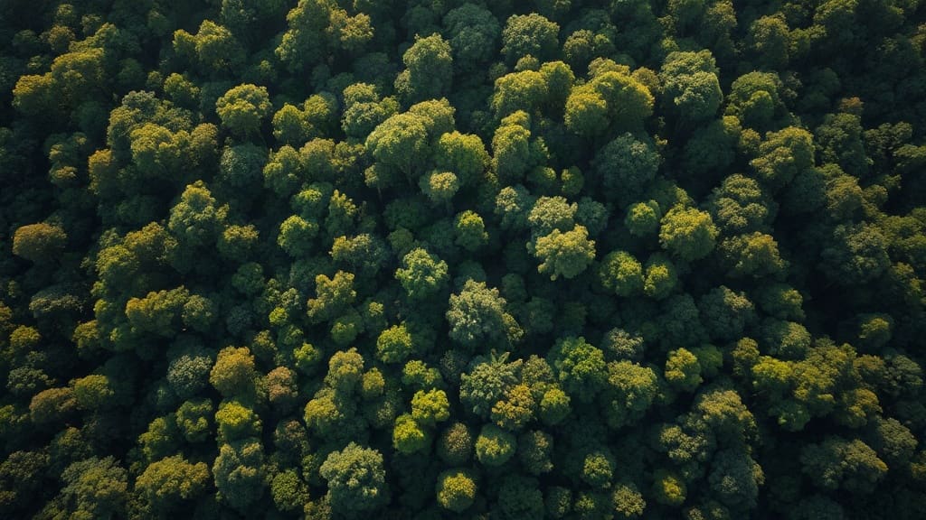
From a satellite, the Amazon can look like an endless green carpet, but that flat view hides a complex three-dimensional world. Birds that live in the canopy navigate a landscape of light gaps, emergent trees, and dense understory. Now, a new generation of high-resolution canopy maps is helping scientists understand exactly how those structural details influence where different bird species live and how they might respond as the forest changes.
Seeing the Forest for the Trees, in 3D
For decades, ecologists studying tropical birds relied on ground-based surveys and rough habitat categories. A forest was either primary, secondary, or disturbed. But that broad-brush approach missed the fine-scale variation that matters to a bird looking for a place to nest or forage. New mapping technologies, including LiDAR (Light Detection and Ranging) and high-resolution satellite imagery, now allow researchers to measure canopy height, leaf density, and vertical complexity across vast areas. These high-tech canopy maps turn the forest into a measurable grid of structural features.
LiDAR works by firing laser pulses from an aircraft or drone and measuring how long they take to bounce back. The result is a detailed 3D model of the forest, from the ground to the topmost leaves. When combined with multispectral imagery, which captures information beyond what the human eye can see, scientists can distinguish not just tree height but also subtle differences in vegetation health and composition.
Why Structure Matters to Birds
Birds don't just need trees; they need the right arrangement of branches, leaves, and open space. A species that hawks insects from a high perch may prefer emergents that poke above the main canopy. A understory insectivore might need dense thickets for cover. Even small changes in canopy openness can affect temperature, humidity, and food availability. By overlaying bird survey data with the new structural maps, researchers are finding that bird communities shift predictably along gradients of canopy height and complexity.
This isn't just an academic exercise. Understanding these relationships helps explain how birds use existing habitats, how they respond to threats like logging and fires, and which communities may be most at risk as forests change. The maps provide a kind of early warning system: if a species is tightly linked to a specific structural feature, and that feature is disappearing, the species is likely in trouble.
Mapping the Invisible
One of the most exciting aspects of this research is its ability to reveal patterns that were previously invisible. For example, a forest that looks uniform from above may actually contain a mosaic of microhabitats. A slight dip in the terrain might create a cooler, moister pocket that supports a different set of plants and insects, which in turn attract different birds. LiDAR can detect these subtle topographic and structural variations, allowing scientists to predict where certain bird species are likely to occur even before they conduct a survey.
This predictive power is invaluable for conservation planning. Instead of protecting only large blocks of pristine forest, managers can identify and safeguard critical microhabitats within otherwise degraded landscapes. It also helps in restoring forests: if we know which structural elements are most important for target species, we can design restoration projects that recreate those features.
From Data to Conservation Action
The transition from research to on-the-ground conservation is never straightforward, but canopy mapping is already influencing how scientists and policymakers think about Amazonian birds. In some regions, these maps are being used to prioritize areas for protection and to monitor the effectiveness of protected areas. They can also help predict how bird communities will shift under different climate change scenarios.
For example, if a species relies on cool, humid microclimates in the understory, and climate models predict that those conditions will disappear from certain areas, conservationists can plan corridors to help the species move to more suitable locations. Similarly, if a bird needs tall emergents for nesting, logging practices that remove those trees can be adjusted to leave some behind.
The Bigger Picture: Why This Matters Beyond Birds
Birds are often called indicators of ecosystem health. Because they are relatively easy to survey and respond quickly to environmental changes, they can signal broader problems. If bird communities are shifting due to changes in forest structure, it's likely that other taxa, from insects to mammals, are also affected. The new canopy maps thus offer a window into the overall integrity of the Amazon.
Moreover, the Amazon is not just a collection of trees; it's a massive carbon sink and a driver of regional climate. Understanding its structure and how it's changing is crucial for global climate predictions. The same LiDAR data that helps track birds can also be used to estimate biomass and carbon storage, making it a dual-purpose tool.
Challenges and Next Steps
Despite the promise, there are hurdles. LiDAR surveys are expensive and logistically challenging in remote areas. Cloud cover in the tropics can limit satellite imagery. And translating structural maps into meaningful conservation actions requires collaboration between ecologists, remote sensing experts, and local stakeholders.
Still, the trajectory is clear. As technology improves and costs come down, high-resolution canopy mapping is becoming more accessible. The next step is to integrate these maps with long-term bird monitoring data and to develop user-friendly tools that conservationists can use without needing a Ph.D. in remote sensing.
Frequently Asked Questions
How do high-tech canopy maps actually help protect Amazon birds?
They identify which structural features, such as canopy height or density, are critical for different bird species. Conservationists can then protect or restore those specific features, even in areas that are not pristine forest.
What kinds of birds benefit most from this research?
Species with specialized habitat needs, like understory insectivores or canopy frugivores, are most sensitive to structural changes. They are also the ones most likely to be helped by targeted conservation based on canopy maps.
Can these maps predict how birds will respond to climate change?
They can help model shifts in suitable habitat under different climate scenarios, but predictions are still uncertain. The maps provide a foundation for more accurate forecasts when combined with climate data.
Is this technology only useful for birds?
No. The same structural data can inform studies of other wildlife, carbon storage, and even hydrology. Birds are just one beneficiary of better forest mapping.
What can ordinary people do to support this work?
Supporting organizations that fund tropical research and conservation, and advocating for policies that protect Amazonian habitats, are practical ways to help. Raising awareness about the importance of forest structure is also valuable.